Datameteo assures complete global weather coverage including sophisticated weather forecasts, maps, tracking and alert services (tornado, strong rain/snow, hail, sat fire monitoring) covering, with the aids of our high resolution weather and wave models, more than 5.000.000 of International locations worldwide simply digiting latitude and longitude. Sea Data points are available for and all the seas (Mediterranean Pacific, Atlantic,Indian) . Specific location or customization setup available on request.
Download the Brochure All the data , forecasts, images , videos. are provided by a 365x7x24 fully scalable cloud server interface
- RAW WEATHER DATA AND FORECAST VIA API We offer climate, currents, forecasts, alerts via our robust API ( Application Protocol Interface ) able to display updated real time weather feeds . In this way you can have your fresh weather outputs simply digiting the latititude and longitue location. This service is available worldwide at the different resolutions of the weather area domain. These type of outputs assure an intuitive, scalable and economical service easy to be tailored on the customer needs. A world of weather data and accurate forecast available for web app too.
- SOFTWARE AND SPECIAL PROJECTS
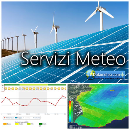
Check our specialist weather solutions like MeteoBrowser2 and software platforms: we offer a wide range of weather maps, data and customization services and all in one ready to run weather archives and preditions for renewable energies, martitime, aviation, agricultural and many other fields.From a global perspective down to street level, you are only limited by your imagination
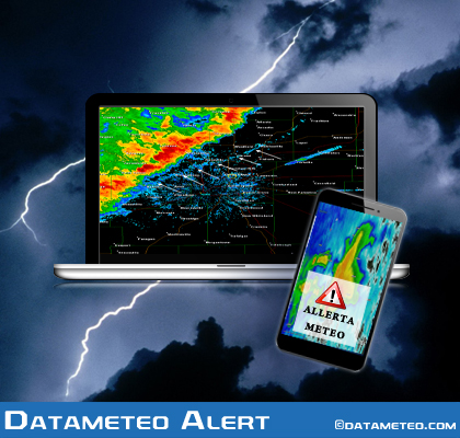
Datameteo Alert is the interactive alerting platform that presents accurate severe weather. This severe weather alerting powers Alerts Broadcaster with its robust and accurate weather data. The result is timely alerting of weather and natural hazard threats mainly regarding wind, temperatures and precipitation amount risk interfaced with our 2-3D Gis weather browser interface named: MeteoBrowser2
Set up personalized weather alerts through an easy to use web or mobile platform. Notifications can be sent to multiple users. Alert types include forecast, Advisories, lightning, and storm threats, which are exclusive to Datameteo.
Nowadays weather is one of the most important word in our daily life. Internet is full of weather sources and for many people the search of the most reliable forecast this is becoming a true obsession.
Yesterday and actual weather can be known not only in places where a meteorological station has been installed.
Current observations are quality-controlled during data processing and these results are made available to users.The quality control check has been developed in-house using our meteorologist expertise ad an added value
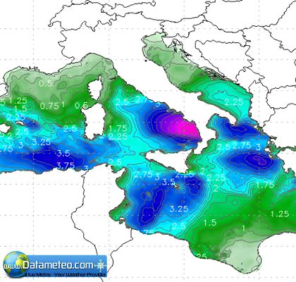
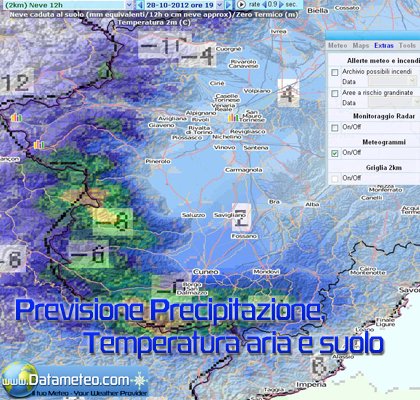
Datameteo WRFs numerical weather forecasts cover 168-180 hours from the moment of initialization to the end, updated 2-4 or several times a day, depending on the area model domain. The WRF model solvers used are the NEMS (numerical multi scale model) and EMM ( Eulerian Mass Model derived by the ARW architecture). We also assimlate the new generation global model like: ICON, ARPEGE, COSMO and the new frontier of the wave modelling with the DWD GWAVE.
An advanced weather API to power all of your business needs, from the basic to the most complex weather influenced solutions.
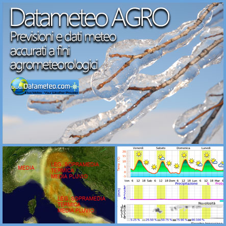
In agriculture and the enviroment is very important knowing in advance with some reliability whether it will rain or not, if there are late frosts, hail damaging, flash floods or drought with high temperatures. This allows to program any irrigation operation, crop spraying and phyto-sanitary treatments or activate a protection from hail or fire..
Datameteo provides agriculture specific weather information and forecasts. From our API with extensive and unique data layers to our enterprise level software, you will find what you need to be successful in the ag field.
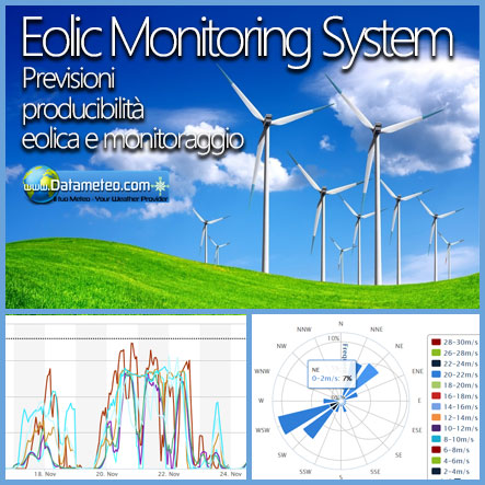
Uncertainty is a common denominator for renewable energies.Weather has a significant impact on both the energy and utility industries.
Uncertain analysis is an important part of any assessment of the long-term energy production of a wind farm.
Although an uncertainty analysis needs to be considered on a site-specific basis and need of specific data collected into and efficient ad user-friendly platform.
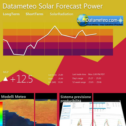
The power generation of solar systems is determined by the radiation values for GHI (Global Horizontal Irradiance), DNI (Direct Normal Irradiance), DIF (Diffuse Horizontal Irradiance) or Tilted radiation.
The high resolution of the Datameteo models allows a very exact parameterization of clouds and atmospheric water. Therefore exact radiation forecasting is possible.
Accurate operational inflow forecasting in combination with optimization tools can significantly improve the economics of your hydropower production.
Among its benefits, reliable short term stream flow forecasts from one day to 12 months ahead, combined with optimization can be used to increase the flood capacity of reservoirs, minimize spill, and maximize energy generation.
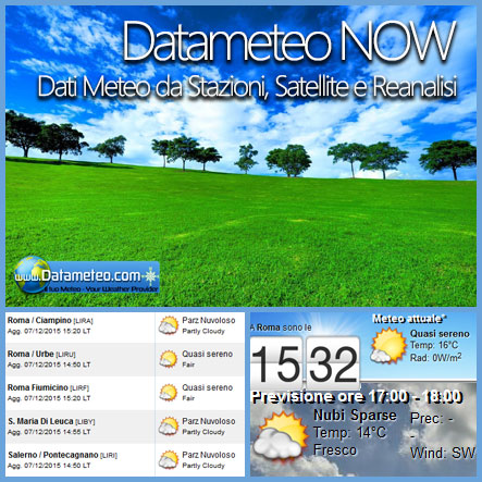
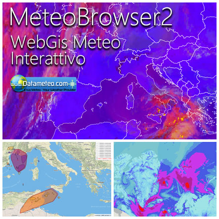
MeteoBrowser 2 is our new 2D-3D geolocated content delivery system that can display all types of real-time weather information, high resolution weather model maps, fire and weather alerts.
The extensive family of our weather data services (data, forecast,sat, webcams) offered is combined into a single product.
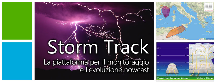
Weather satellites are used to get a space-bird's eye view of Earth's atmosphere.
Visible and infrared images are used to detect the amount of water vapour at various altitude or and ground and sea temperatures while winds can be calculated by measuring cloud motion and precipitation amount estimated. Storm Track is able to active monitor and nowcast the t-storm cells motions
Datameteo (trade mark powered by LRC inc) combines meteorological skills with the best technology to propose innovative weather solutions extremely scalable, from the simple xml application or CSV feed working on your hosting, to the most innovative weather platform that requires and enterprise environments but can easily integrated with third-party offerings.This help companies to realize increased visibility profits and customer loyalty. We are located in Italy operating since 2000 with an international focus relative at weather applications. The website is one of the most popular weather site for people interested in flying, skydiving, kitesurfing, gliding, paragliding, boating, sailing or in general weather data and forecast worldwide.
Through our cluster servers located in a conditinated and securized datacenter wth redundant power supply and mutiple internet network connections we offer a wide range of weather services based on our high resolution weather (WRF) wave (WWW3-Hycom), climate (CFS) models, data customization services (web, video etc..)and innovative weather platform like the new Virtual Wind Farm Maker or the new Meteobrowser high resolution weather planner. Datameteo is proud to serve customers ranging form the webcompany to the tour operator hadling societies port authorities.All the high resolution weather and marine models and hurricane tracking system and weather products ( data, maps, videos) are available for every location, sea, zone all over the world.
We also provide a very specialized weather info via AERO, AGRO, SKI, SAILING, ALERT that are exciting new weather content delivery systems that can display all types of real-time weather information in a quick, concise and user-friendly format based on Meteograms . Check our specialist weather channels AERO, AGRO, SKI , SAILING; ALERT and the new 2 Km grid WRF EMM (Eulerian Mass Model) weather model and for more information visit our pages.